IPH-0060200AIRCRAFT MOUNTED WEATHER RADAR TRANSMITTER
Garmin International Inc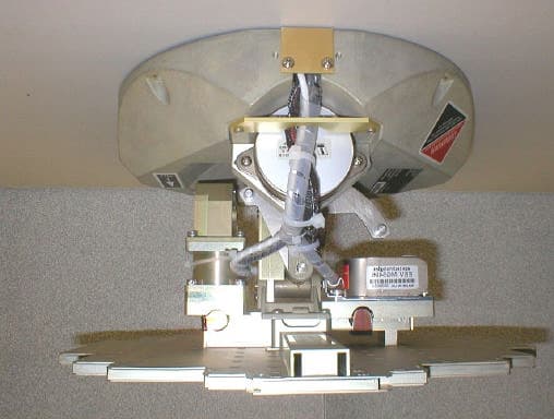
Click to zoom
Application Details
- Equipment Class
- TNB - Licensed Non-Broadcast Station Transmitter
- Date of Grant
- May 26, 2005
- Application Purpose
- Original Equipment
- Date of Application
- May 26, 2005
- Equipment Note
- AIRCRAFT MOUNTED WEATHER RADAR TRANSMITTER
- Frequency Range
- 9300.00000000 - 9500.00000000
- Company
- Garmin International Inc
- Country
- United States
Documents & Files
Document Text
Text extracted from the exhibit documents filed with the FCC. Open a document above to read the original.
Users Manual
G1000 TM hazard avoidance pilot’s guide for the Cessna Citation Mustang Preliminary 190-00498-00_0A.indd 13/1/2005 10:33:38 AM Garmin G1000 Hazard Avoidance Pilot’s Guide for the Cessna Citation Mustang190-00498-00 Draft Record of Revisions RevisionDate of RevisionRevision Page RangeDescription Draft 03/01/057-1 – 7-53Initial release. Preliminary 190-00498-00_0A.indd 23/1/2005 10:33:38 AM Garmin G1000 Hazard Avoidance Pilot’s Guide for the Cessna Citation Mustang190-00498-00 Draft 7-1 WEATHER This document describes the Hazard Avoidance features of the G1000 system. The main hazards to flight safety are flying in or near weather, flying in close proximity to the terrain and other flight traffic in close proximity. The information contained in this section assumes un - derstanding of the G1000 Multi Function Display. This section is divided into groups as follows: Weather • GDL 69A (XM Weather) • GWX 68 • WX 500 Stormscope TAWS/Terrain • Terrain Proximity • TAWS (Terrain Awareness Warning System) Traffic • TIS (Traffic Information System) • TAS (Traffic Advisory System) 7.1 WEATHER CAUTION: GDL 69A NEXRAD weather data is to be used for long-range planning purposes only. Due to inherent delays and relative age of the data that can be received, NEXRAD weather data should not be used for short-range avoidance of weather. WARNING: Use of any GDL 69A Weather Product for thunderstorm penetration is prohibited. Weather information provided by the GDL 69 is approved only for weather avoidance, not penetration. Preliminary 190-00498-00_0A.indd 13/1/2005 10:33:39 AM Garmin G1000 Hazard Avoidance Pilot’s Guide for the Cessna Citation Mustang190-00498-00 Draft 7-2 WEATHER GDL 69A WEATHER AND DIGITAL AUDIO ENTERTAINMENT The GDL 69A is a remote sensor that is capable of re- ceiving XM Weather and displaying it on the G1000 Multi Function Display and the Primary Flight Display Inset Map. The GDL 69A is also capable of receiving XM Radio Services. XM Weather and XM Radio operate in the S- band frequency range to provide continuous uplink capa- bilities at any altitude throughout North America. NOTE: Before the GDL 69A can be used, the unit must be activated by XM Satellite Radio. The XM Satellite Radio Activation Instruction Sheet con - tains important information required to initiate XM Satellite Radio Subscription for the GDL 69A. This sheet was given to the aircraft owner at the time of delivery. NOTE: Refer to the G1000 Option pilot’s guide for information on the XM entertainment radio segment of the GDL 69A. Radio IDs The GDL 69A are shipped with a Data Radio ID and an Audio Radio ID. You must obtain the Radio IDs of your receiver(s) before subscribing to XM services. The IDs are attached to the XM Satellite Radio Activation Instructions sheet included with the unit. They are also printed on a label on the back of the unit and are displayed on the XM Information Page. Contact the installer if you are unable to locate the Radio IDs. Activating XM Radio Services To activate the XM Radio Weather Service: 1. Turn the large FMS knob to select the Auxiliary Page Group. Turn the small FMS knob to display the AUX - XM Page. 2. Press the INFO softkey to display the XM Information Page. 3. Contact XM Satellite Radio through the Internet or by telephone. Follow the directions provided by XM Satellite Radio. 4. Verify that the desired services are activated and press the DONE softkey. 5. Turn the large FMS knob to highlight ‘YES’ or ‘NO.’ Press the ENT key to complete activation. Preliminary 190-00498-00_0A.indd 23/1/2005 10:33:39 AM Garmin G1000 Hazard Avoidance Pilot’s Guide for the Cessna Citation Mustang190-00498-00 Draft 7-3 WEATHER Figure 7.1.1 XM Information Page Audio Radio ID DONE Softkey Weather Products Data Radio ID INFO Softkey Preliminary 190-00498-00_0A.indd 33/1/2005 10:33:39 AM Garmin G1000 Hazard Avoidance Pilot’s Guide for the Cessna Citation Mustang190-00498-00 Draft 7-4 WEATHER GDL 69 WEATHER Flight Information Services (FIS) weather information provided by the GDL 69 is displayed on the following MFD Maps and Pages: • Navigation Map Page ( NEXRAD and XM Light- ning only) • Weather Data Link Page (complete GDL 69 capa- bility) • Nearest Pages (NEXRAD and XM Lightning only) • Airport Information Page (NEXRAD and XM Lightning only) • Flight Planning Maps (NEXRAD and XM Light- ning only) • AUX - Trip Planning Map (NEXRAD and XM Lightning only) • WPT - Weather Information Page - part of the WPT - Airport Information Page (METAR and TAF information only) FIS weather information is also displayed on the Pri - mary Flight Display Inset Map. See the G1000 PFD Pilot’s Guide for more information. NOTE: Temporary Flight Restrictions (TFRs) are displayed on all pages. Cell Movement is always displayed with NEXRAD data. Complete GDL 69 capabilities include: • Graphical NEXRAD Data (NEXRAD) • Graphical METAR Data (METAR) • Textual METAR Data • Textual Terminal Aerodrome Forecasts (TAF) • City Forecast Data • Graphical Wind Data (WIND) • Graphical Echo Tops (ECHO TOP) • Graphical Cloud Tops (CLD TOP) • Graphical Lightning Strikes (XM LTNG) • Graphical Storm Cell Movement (CELL MOV) • NEXRAD Radar Coverage (displayed with NEXRAD data) • SIGMETs/AIRMETs (SIG/AIR) • Surface Analysis including City Forecasts (SFC) • County Warnings (COUNTY) • Freezing Levels (FRZ LVL) • Hurricane Track (CYCLONE) • Temporary Flight Restrictions (TFR) NOTE: FIS (also known as Flight Information Services - Broadcast, or FIS-B) supplies real-time weather information and other flight advisory information for enhanced situational awareness, 24 hours a day, 7 days a week. Preliminary 190-00498-00_0A.indd 43/1/2005 10:33:40 AM Garmin G1000 Hazard Avoidance Pilot’s Guide for the Cessna Citation Mustang190-00498-00 Draft 7-5 WEATHER Displaying Weather Data on the Navigation Map Page When appropriately configured, the Navigation Map Page displays NEXRAD, Cell Movement, TFRs and XM Lightning data. This capability improves situational awa…
Text truncated - open the document above for the full version.
Users Manual
The following fi les have been archived under the aboce ARCHIVE FILENAME. Filename File Contents Date: Drafter: Checker: Project Engineer: Released By: TITLE: PART NO: SIZE A Scale: N/A REV. Page of REVISIONS SPECIFICATION CONTROL DRAWING REV. DATE DESCRIPTION ECO NO. Garmin Ltd. or its subsidiaries c/o Garmin International, Inc. 1200 E. 151st Street Olathe, Kansas 66062 U.S.A. CONFIDENTIAL This drawing and the specifi cations contained herein are the property of Garmin Ltd. or its subsidiaries and may not be reproduced or used in whole or in part as the basis for manufacture or sale of products without written permission . 30 190-00286-01.pdf 190-00286-01.pdf 190-00286-01 GWX 68 Installation Manual 1 1 36 GWX 68 Installation Manual 5 1 5/12/05 Preliminary Release --------- NOTES: 1. DESCRIPTION: Installation Documentation - 2. PAGE SIZE: Letter: Width = 8.5 inches, Height = 11 inches Tabloid: Width = 11.0 inches, Height = 17.0 inches 3. PAGINATION: double-sided letter sheets. single-sided tabloid sheets. 4. MATERIAL: 24 pound bond. Approved equivalents allowed. 5. COLOR: Black Ink on White Paper Stock. 6. BINDERY: Three-hole punch, shrink-wrap. Digital output preferred 7. FOLDS: Z-Fold tabloid sheets at end of document. 8. ELECTRONIC ARTWORK: Shall Conform to Garmin Archive, Filename: Portable Document Format, contains Installation Manual and Release Specifi cation release.indd Adobe InDesign Format, Release Specifi cation Manual Elements Word 97 for PC, Formatted Files and Figures *.* Various supporting illustrations, drawings, and artwork. 8.5" 11" 3-Hole Punch GWX 68 Installation Manual DER REVIEW REQUIRED Garmin P/N 190-00286-01May, 2005Preliminary Revision 1 Preliminary GWX 68 Installation Manual Page AGWX 68 Installation Manual Preliminary Revision 1190-00286-01 © Copyright 2005 Garmin Ltd. or its subsidiaries All Rights Reserved Except as expressly provided herein, no part of this manual may be reproduced, copied, transmitted, disseminated, downloaded or stored in any storage medium, for any purpose without the express prior written consent of Garmin. Garmin hereby grants permission to download a single copy of this manual and of any revision to this manual onto a hard drive or other electronic storage medium to be viewed and to print one copy of this manual or of any revision hereto, provided that such electronic or printed copy of this manual or revision must contain the complete text of this copyright notice and provided further that any unauthorized commercial distribution of this manual or any revision hereto is strictly prohibited. Garmin International, Inc. 1200 E. 151 st Street Olathe, KS 66062 USA Telephone: 913-397-8200 Aviation Dealer Technical Support Line (Toll Free): (888) 606-5482 www.garmin.com Garmin (Europe) Ltd. Unit 5, The Quadrangle Abbey Park Industrial Estate Romsey, SO51 9DL U.K. 44/ 0870.851241 RECORD OF REVISIONS RevisionRevision Date DescriptionECO # 15/12/05Initial Release-------- DOCUMENT PAGINATION SectionPage Range Table of Contentsi - vi Section 11-1 – 1-6 Section 22-1 – 2-2 Section 33-1 – 3-10 Section 44-1 – 4-4 Appendix AA-1 – A-2 Appendix BB-1 – B-8 GWX 68 Installation ManualPage i 190-00286-01Preliminary Revision 1 This manual reflects the operation of software version TBD. Some differences in operation may be observed when comparing the information in this manual to earlier or later software versions. INFORMATION SUBJECT TO EXPORT CONTROL LAWS This document may contain information which is subject to the Export Administration Regulations ("EAR") issued by the United States Department of Commerce (15 CFR, Chapter VII, Subchapter C) and which may not be exported, released, or disclosed to foreign nationals inside or outside of the United States without first obtaining an export license. A violation of the EAR may be subject to a penalty of up to 10 years imprisonment and a fine of up to $1,000,000 under Section 2410 of the Export Administration Act of 1979. Include this notice with any reproduced portion of this document. WARNING This product, its packaging, and its components contain chemicals known to the State of California to cause cancer, birth defects, or reproductive harm. This Notice is being provided in accordance with California's Proposition 65. If you have any questions or would like additional information, please refer to our web site at www.garmin.com/prop65. WARNING This radar device produces microwave radiation. DO NOT OPERATE THIS DEVICE UNTIL ALL SAFETY PRECAUTIONS AND INSTRUCTIONS IN THE OPERATING AND INSTALL MANUALS HAVE BEEN READ. IMPROPER USE OR EXPOSURE MAY RESULT IN BODILY INJURY. CAUTION All personnel should remain the prescribed “safe distance” from this radar. Never expose any part of the body to an unterminated waveguide. Page iiGWX 68 Installation Manual Preliminary Revision 1190-00286-01 SAFE DISTANCE DETERMINATION The following information establishes a minimum safe distance from the antenna for personnel near an operating airborne weather radar. The minimum safe distance is based upon the FCC’s exposure limit at 9.3 to 9.5 GHz for general population/uncontrolled environments which is 1 mW/cm 2 . See AC 20-68B for more information on safe distance determination. Antenna SizeSafe Distance 10”9.16 ft 12”10.8 ft MAXIMUM PERMISSIBLE EXPOSURE LEVEL (MPEL) The zone in which the radiation level exceeds the US Government standard of 1 mW/cm 2 , is the semi- circular area of at least 9.16 ft from the 10” antenna and 10.83 ft from the 12” antenna as indicated in the illustration below. All personnel must remain outside of this zone. The distance to the MPEL boundary is calculated upon the basis of each antenna available with the GWX 68 system, rated output power of the transmitter, and in the non-rotating or boresight position of the antenna (see example calculations above). With a scanning or rotating beam, the averaged power density at the MPEL boundary is significantly reduced. MPEL Boundary Radome Center Line of Aircraft…
Text truncated - open the document above for the full version.
Users Manual
G1000 TM hazard avoidance pilot’s guide for the Cessna Citation Mustang Preliminary 190-00498-00_0A.indd 13/1/2005 10:33:38 AM Garmin G1000 Hazard Avoidance Pilot’s Guide for the Cessna Citation Mustang190-00498-00 Draft Record of Revisions RevisionDate of RevisionRevision Page RangeDescription Draft 03/01/057-1 – 7-53Initial release. Preliminary 190-00498-00_0A.indd 23/1/2005 10:33:38 AM Garmin G1000 Hazard Avoidance Pilot’s Guide for the Cessna Citation Mustang190-00498-00 Draft 7-1 WEATHER This document describes the Hazard Avoidance features of the G1000 system. The main hazards to flight safety are flying in or near weather, flying in close proximity to the terrain and other flight traffic in close proximity. The information contained in this section assumes un - derstanding of the G1000 Multi Function Display. This section is divided into groups as follows: Weather • GDL 69A (XM Weather) • GWX 68 • WX 500 Stormscope TAWS/Terrain • Terrain Proximity • TAWS (Terrain Awareness Warning System) Traffic • TIS (Traffic Information System) • TAS (Traffic Advisory System) 7.1 WEATHER CAUTION: GDL 69A NEXRAD weather data is to be used for long-range planning purposes only. Due to inherent delays and relative age of the data that can be received, NEXRAD weather data should not be used for short-range avoidance of weather. WARNING: Use of any GDL 69A Weather Product for thunderstorm penetration is prohibited. Weather information provided by the GDL 69 is approved only for weather avoidance, not penetration. Preliminary 190-00498-00_0A.indd 13/1/2005 10:33:39 AM Garmin G1000 Hazard Avoidance Pilot’s Guide for the Cessna Citation Mustang190-00498-00 Draft 7-2 WEATHER GDL 69A WEATHER AND DIGITAL AUDIO ENTERTAINMENT The GDL 69A is a remote sensor that is capable of re- ceiving XM Weather and displaying it on the G1000 Multi Function Display and the Primary Flight Display Inset Map. The GDL 69A is also capable of receiving XM Radio Services. XM Weather and XM Radio operate in the S- band frequency range to provide continuous uplink capa- bilities at any altitude throughout North America. NOTE: Before the GDL 69A can be used, the unit must be activated by XM Satellite Radio. The XM Satellite Radio Activation Instruction Sheet con - tains important information required to initiate XM Satellite Radio Subscription for the GDL 69A. This sheet was given to the aircraft owner at the time of delivery. NOTE: Refer to the G1000 Option pilot’s guide for information on the XM entertainment radio segment of the GDL 69A. Radio IDs The GDL 69A are shipped with a Data Radio ID and an Audio Radio ID. You must obtain the Radio IDs of your receiver(s) before subscribing to XM services. The IDs are attached to the XM Satellite Radio Activation Instructions sheet included with the unit. They are also printed on a label on the back of the unit and are displayed on the XM Information Page. Contact the installer if you are unable to locate the Radio IDs. Activating XM Radio Services To activate the XM Radio Weather Service: 1. Turn the large FMS knob to select the Auxiliary Page Group. Turn the small FMS knob to display the AUX - XM Page. 2. Press the INFO softkey to display the XM Information Page. 3. Contact XM Satellite Radio through the Internet or by telephone. Follow the directions provided by XM Satellite Radio. 4. Verify that the desired services are activated and press the DONE softkey. 5. Turn the large FMS knob to highlight ‘YES’ or ‘NO.’ Press the ENT key to complete activation. Preliminary 190-00498-00_0A.indd 23/1/2005 10:33:39 AM Garmin G1000 Hazard Avoidance Pilot’s Guide for the Cessna Citation Mustang190-00498-00 Draft 7-3 WEATHER Figure 7.1.1 XM Information Page Audio Radio ID DONE Softkey Weather Products Data Radio ID INFO Softkey Preliminary 190-00498-00_0A.indd 33/1/2005 10:33:39 AM Garmin G1000 Hazard Avoidance Pilot’s Guide for the Cessna Citation Mustang190-00498-00 Draft 7-4 WEATHER GDL 69 WEATHER Flight Information Services (FIS) weather information provided by the GDL 69 is displayed on the following MFD Maps and Pages: • Navigation Map Page ( NEXRAD and XM Light- ning only) • Weather Data Link Page (complete GDL 69 capa- bility) • Nearest Pages (NEXRAD and XM Lightning only) • Airport Information Page (NEXRAD and XM Lightning only) • Flight Planning Maps (NEXRAD and XM Light- ning only) • AUX - Trip Planning Map (NEXRAD and XM Lightning only) • WPT - Weather Information Page - part of the WPT - Airport Information Page (METAR and TAF information only) FIS weather information is also displayed on the Pri - mary Flight Display Inset Map. See the G1000 PFD Pilot’s Guide for more information. NOTE: Temporary Flight Restrictions (TFRs) are displayed on all pages. Cell Movement is always displayed with NEXRAD data. Complete GDL 69 capabilities include: • Graphical NEXRAD Data (NEXRAD) • Graphical METAR Data (METAR) • Textual METAR Data • Textual Terminal Aerodrome Forecasts (TAF) • City Forecast Data • Graphical Wind Data (WIND) • Graphical Echo Tops (ECHO TOP) • Graphical Cloud Tops (CLD TOP) • Graphical Lightning Strikes (XM LTNG) • Graphical Storm Cell Movement (CELL MOV) • NEXRAD Radar Coverage (displayed with NEXRAD data) • SIGMETs/AIRMETs (SIG/AIR) • Surface Analysis including City Forecasts (SFC) • County Warnings (COUNTY) • Freezing Levels (FRZ LVL) • Hurricane Track (CYCLONE) • Temporary Flight Restrictions (TFR) NOTE: FIS (also known as Flight Information Services - Broadcast, or FIS-B) supplies real-time weather information and other flight advisory information for enhanced situational awareness, 24 hours a day, 7 days a week. Preliminary 190-00498-00_0A.indd 43/1/2005 10:33:40 AM Garmin G1000 Hazard Avoidance Pilot’s Guide for the Cessna Citation Mustang190-00498-00 Draft 7-5 WEATHER Displaying Weather Data on the Navigation Map Page When appropriately configured, the Navigation Map Page displays NEXRAD, Cell Movement, TFRs and XM Lightning data. This capability improves situational awa…
Text truncated - open the document above for the full version.
Users Manual
The following fi les have been archived under the aboce ARCHIVE FILENAME. Filename File Contents Date: Drafter: Checker: Project Engineer: Released By: TITLE: PART NO: SIZE A Scale: N/A REV. Page of REVISIONS SPECIFICATION CONTROL DRAWING REV. DATE DESCRIPTION ECO NO. Garmin Ltd. or its subsidiaries c/o Garmin International, Inc. 1200 E. 151st Street Olathe, Kansas 66062 U.S.A. CONFIDENTIAL This drawing and the specifi cations contained herein are the property of Garmin Ltd. or its subsidiaries and may not be reproduced or used in whole or in part as the basis for manufacture or sale of products without written permission . 30 190-00286-01.pdf 190-00286-01.pdf 190-00286-01 GWX 68 Installation Manual 1 1 36 GWX 68 Installation Manual 5 1 5/12/05 Preliminary Release --------- NOTES: 1. DESCRIPTION: Installation Documentation - 2. PAGE SIZE: Letter: Width = 8.5 inches, Height = 11 inches Tabloid: Width = 11.0 inches, Height = 17.0 inches 3. PAGINATION: double-sided letter sheets. single-sided tabloid sheets. 4. MATERIAL: 24 pound bond. Approved equivalents allowed. 5. COLOR: Black Ink on White Paper Stock. 6. BINDERY: Three-hole punch, shrink-wrap. Digital output preferred 7. FOLDS: Z-Fold tabloid sheets at end of document. 8. ELECTRONIC ARTWORK: Shall Conform to Garmin Archive, Filename: Portable Document Format, contains Installation Manual and Release Specifi cation release.indd Adobe InDesign Format, Release Specifi cation Manual Elements Word 97 for PC, Formatted Files and Figures *.* Various supporting illustrations, drawings, and artwork. 8.5" 11" 3-Hole Punch GWX 68 Installation Manual DER REVIEW REQUIRED Garmin P/N 190-00286-01May, 2005Preliminary Revision 1 Preliminary GWX 68 Installation Manual Page AGWX 68 Installation Manual Preliminary Revision 1190-00286-01 © Copyright 2005 Garmin Ltd. or its subsidiaries All Rights Reserved Except as expressly provided herein, no part of this manual may be reproduced, copied, transmitted, disseminated, downloaded or stored in any storage medium, for any purpose without the express prior written consent of Garmin. Garmin hereby grants permission to download a single copy of this manual and of any revision to this manual onto a hard drive or other electronic storage medium to be viewed and to print one copy of this manual or of any revision hereto, provided that such electronic or printed copy of this manual or revision must contain the complete text of this copyright notice and provided further that any unauthorized commercial distribution of this manual or any revision hereto is strictly prohibited. Garmin International, Inc. 1200 E. 151 st Street Olathe, KS 66062 USA Telephone: 913-397-8200 Aviation Dealer Technical Support Line (Toll Free): (888) 606-5482 www.garmin.com Garmin (Europe) Ltd. Unit 5, The Quadrangle Abbey Park Industrial Estate Romsey, SO51 9DL U.K. 44/ 0870.851241 RECORD OF REVISIONS RevisionRevision Date DescriptionECO # 15/12/05Initial Release-------- DOCUMENT PAGINATION SectionPage Range Table of Contentsi - vi Section 11-1 – 1-6 Section 22-1 – 2-2 Section 33-1 – 3-10 Section 44-1 – 4-4 Appendix AA-1 – A-2 Appendix BB-1 – B-8 GWX 68 Installation ManualPage i 190-00286-01Preliminary Revision 1 This manual reflects the operation of software version TBD. Some differences in operation may be observed when comparing the information in this manual to earlier or later software versions. INFORMATION SUBJECT TO EXPORT CONTROL LAWS This document may contain information which is subject to the Export Administration Regulations ("EAR") issued by the United States Department of Commerce (15 CFR, Chapter VII, Subchapter C) and which may not be exported, released, or disclosed to foreign nationals inside or outside of the United States without first obtaining an export license. A violation of the EAR may be subject to a penalty of up to 10 years imprisonment and a fine of up to $1,000,000 under Section 2410 of the Export Administration Act of 1979. Include this notice with any reproduced portion of this document. WARNING This product, its packaging, and its components contain chemicals known to the State of California to cause cancer, birth defects, or reproductive harm. This Notice is being provided in accordance with California's Proposition 65. If you have any questions or would like additional information, please refer to our web site at www.garmin.com/prop65. WARNING This radar device produces microwave radiation. DO NOT OPERATE THIS DEVICE UNTIL ALL SAFETY PRECAUTIONS AND INSTRUCTIONS IN THE OPERATING AND INSTALL MANUALS HAVE BEEN READ. IMPROPER USE OR EXPOSURE MAY RESULT IN BODILY INJURY. CAUTION All personnel should remain the prescribed “safe distance” from this radar. Never expose any part of the body to an unterminated waveguide. Page iiGWX 68 Installation Manual Preliminary Revision 1190-00286-01 SAFE DISTANCE DETERMINATION The following information establishes a minimum safe distance from the antenna for personnel near an operating airborne weather radar. The minimum safe distance is based upon the FCC’s exposure limit at 9.3 to 9.5 GHz for general population/uncontrolled environments which is 1 mW/cm 2 . See AC 20-68B for more information on safe distance determination. Antenna SizeSafe Distance 10”9.16 ft 12”10.8 ft MAXIMUM PERMISSIBLE EXPOSURE LEVEL (MPEL) The zone in which the radiation level exceeds the US Government standard of 1 mW/cm 2 , is the semi- circular area of at least 9.16 ft from the 10” antenna and 10.83 ft from the 12” antenna as indicated in the illustration below. All personnel must remain outside of this zone. The distance to the MPEL boundary is calculated upon the basis of each antenna available with the GWX 68 system, rated output power of the transmitter, and in the non-rotating or boresight position of the antenna (see example calculations above). With a scanning or rotating beam, the averaged power density at the MPEL boundary is significantly reduced. MPEL Boundary Radome Center Line of Aircraft…
Text truncated - open the document above for the full version.
Cover Letter(s)
May 24, 2005 Timco Engineering Inc. 849 NW State Road 45 Newberry, FL 32669 Federal Communications Commission Equipment Approval Services P.O. Box 35815 Pittsburgh, PA 15251-3315 Applicant: Garmin International, Inc. 1200 East 151st Street Olathe, KS 66062 CORES number: 0005-0885-88 Re: Confidentiality for submittal information regarding FCC ID number IPH-0060200 PRODUCT: Aviation Weather Radar operated under part 87. Dear Sirs: Garmin International, Inc. requests that the material in the Schematics, Operational Description, Tune up procedures and Block diagram be withheld from public disclosure in accordance with Section 0.459 of the Commissions Rules, 47 C.F.R. 0.459 (1998), following grant of the application. In support of this request, Garmin International, Inc. submits the following: 1. Identification of the specific information for which confidential treatment is sought: The materials set fourth in the Operational Description, Schematics, tune up procedures, and block diagram, which are segregated from the non-confidential exhibits of the application, are those for which confidentiality is sought. 2. Identification of the Commission proceeding in which the information was submitted or a description of the circumstances giving rise to the submission: The proceeding is that involving the application for equipment authorization (certification) under FCC ID No: IPH-0060200 3. Explanation of the degree to which the information is commercial or financial, or contains a trade secret or is privileged: This material includes a detailed theory of operation, circuit diagrams, confidential tune up procedures, and schematics. As such, this material is treated as highly confidential business information and not available as general information. ROGERS LABS, INC. 4405 West 259 th Terrace Louisburg, KS 66053 4. Explanation of the degree to which the information concerns a service that is subject to competition: The material for which confidentiality is sought is employed in the design and manufacture of this transmitting equipment that is offered on a highly competitive basis. Customers for this equipment have a variety of competing sources. 5. Explanation of how disclosure of the information could result in substantial competitive harm: Disclosure would, in effect, give away the fruits of the labors of Garmin International, Inc.’s engineering personnel, who have designed the equipment and the manufacturing process. Disclosure would also offer competitors additional unwarranted insight into the state of the product development, thereby allowing competitors an advantage, not available to Garmin International, Inc. 6. Identification of any measures taken by the submitting party to prevent unauthorized disclosure: The information for which confidential treatment is sought is kept confidential by Garmin International, Inc. and not made available to third parties except pursuant to non-disclosure agreements. 7. Identification of whether the information is available to the public and the extent of any previous disclosure of the information to third parties: To the knowledge of those preparing this application, the information has not been disclosed publicly heretofore. While the general theory of operation of this equipment has been the subject of numerous disclosures in industry and standards groups as well as in rule making proceedings of the FCC, the protection sought is narrowly drawn and pertains to certain specific implementations of this radio technology. 8. Justification of the period during which the submitting party asserts that the material should not be available for public disclosure: This material should not be disclosed for at least 25 years. While improvements in design are made relatively frequently, disclosure of the design information would lead to insights into both design and manufacturing techniques that could have an adverse competitive effect for many years to come. This equipment is designed for commercial, industrial, and governmental applications. As such, unlike most consumer equipment, this equipment could be used for more than a decade in some cases. As such, it is important that the design not be made available to unauthorized persons who might attempt to use knowledge of the design to compromise the applications for which the equipment will be employed. Should you require any further information, please contact the undersigned. Thank you for your consideration in this matter. Sincerely, Scot Rogers
Cover Letter(s)
May 24, 2005 Timco Engineering Inc. 849 NW State Road 45 Newberry, FL 32669 Federal Communications Commission Equipment Approval Services P.O. Box 35815 Pittsburgh, PA 15251-3315 Applicant: Garmin International, Inc. 1200 East 151st Street Olathe, KS 66062 CORES number: 0005-0885-88 Re: Confidentiality for submittal information regarding FCC ID number IPH-0060200 PRODUCT: Aviation Weather Radar operated under part 87. Dear Sirs: Garmin International, Inc. requests that the material in the Schematics, Operational Description, Tune up procedures and Block diagram be withheld from public disclosure in accordance with Section 0.459 of the Commissions Rules, 47 C.F.R. 0.459 (1998), following grant of the application. In support of this request, Garmin International, Inc. submits the following: 1. Identification of the specific information for which confidential treatment is sought: The materials set fourth in the Operational Description, Schematics, tune up procedures, and block diagram, which are segregated from the non-confidential exhibits of the application, are those for which confidentiality is sought. 2. Identification of the Commission proceeding in which the information was submitted or a description of the circumstances giving rise to the submission: The proceeding is that involving the application for equipment authorization (certification) under FCC ID No: IPH-0060200 3. Explanation of the degree to which the information is commercial or financial, or contains a trade sec…
Text truncated - open the document above for the full version.
Contact Information
Applicant
Ben Karsak(Manager, Compliance Engineering)
Test Firm
Rogers Labs, Inc.Scot Rogers
Technical Specifications
| # | Rule Parts | Frequency Range | Power Output | Emission | Tolerance |
|---|---|---|---|---|---|
| 1 | 87 | 9.30 GHz - 9.50 GHz | 7500 W | 8M00PON | 1097.0000000000 ppm |
Other Applications from Garmin International Inc
IPH-05126
Sep 09, 2026Portable Digital Transceiver
Equipment Class
NII - Unlicensed National Information Infrastructure TXIPH-A5126
Sep 09, 2026Portable Digital Transceiver
Equipment Class
NII - Unlicensed National Information Infrastructure TXIPH-04812
Sep 01, 2026Mobile Digital Transceiver
Equipment Class
DTS - Digital Transmission SystemIPH-A04825
Sep 01, 2026Marine Stereo
Equipment Class
DSS - Part 15 Spread Spectrum TransmitterIPH-B04825
Sep 01, 2026Marine Stereo
Equipment Class
DSS - Part 15 Spread Spectrum Transmitter