IPH-04396Navigation and communication device for use on watercraft.
Garmin International Inc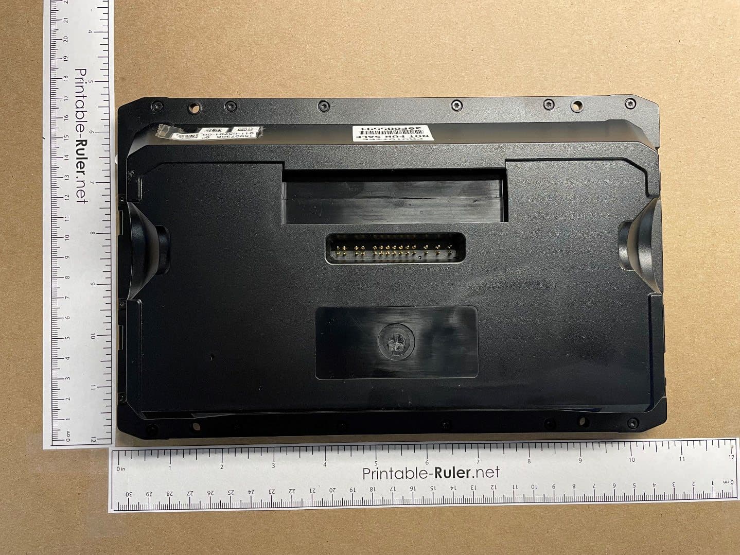
Click to zoom
Application Details
- Equipment Class
- DTS - Digital Transmission System
- Date of Grant
- Dec 08, 2022
- Application Purpose
- Original Equipment
- Date of Application
- Nov 29, 2022
- Equipment Note
- Navigation and communication device for use on watercraft.
- Frequency Range
- 2402.00000000 - 2480.00000000
- Company
- Garmin International Inc
- Country
- United States
Documents & Files
Document Text
Text extracted from the exhibit documents filed with the FCC. Open a document above to read the original.
Users Manual
IMPORTANT SAFETY AND PRODUCT INFORMATION Printed in Taiwan July 2022 190-00720-32_0H Important Safety and Product Information.........................................................3 Informations importantes sur le produit et la sécurité............................................4 Important Safety and Product Information WARNING Failure to heed the following warnings could result in an accident or collision resulting in death or serious injury. Marine Operation Warnings •You are responsible for the safe and prudent operation of your vessel. This device is a tool that will enhance your capability to operate your vessel. This device does not relieve you from the responsibility of safely operating your vessel. Avoid navigational hazards and never leave the helm unattended. • Use this device only as a navigational aid. Do not attempt to use the device for any purpose requiring precise measurement of direction, distance, location, or topography. • Always be prepared to promptly regain control of the vessel. Use caution near hazards in the water, such as docks, pilings and other vessels. • If the device has navigating capabilities, when navigating, carefully compare information displayed on the device to all available navigation sources, including information from visual sightings, local waterway rules and restrictions, and maps. For safety, always resolve any discrepancies or questions before continuing navigation. • If the device uses maps, use the electronic chart in the device only to facilitate, not to replace, the use of authorized government charts. Official government charts and notices to mariners contain all information needed to navigate safely. • Tide and current information is for information purposes only. It is your responsibility to heed all posted water-related guidance, to remain aware of your surroundings, and to use safe judgment in, on, and around the water at all times. Failure to heed this warning could result in serious personal injury or death. • If the device provides depth data, it should not be used as the primary means of preventing grounding or collision. Supplement depth data readings with information from applicable paper charts and visual indicators. Always operate the vessel at slow speeds if you suspect shallow water or submerged objects. Failure to heed this warning could lead to vessel damage or personal injury. • If the device has video input capabilities, do not attempt to operate or watch video input while operating or navigating your vessel. Operating or watching the video input while the vessel is moving could cause an accident or collision resulting in property damage, serious injury, or death. Device Warnings • Do not immerse the device or batteries in water or other liquids. • Do not leave the device exposed to a heat source or in a high-temperature location, such as in the sun in an unattended vessel. To prevent the possibility of damage, remove the device from the vessel or store it out of direct sunlight. • Do not operate the device outside of the temperature ranges specified in the printed manual in the product packaging. • When storing the device for an extended time period, store within the temperature ranges specified in the printed manual in the product packaging. Hearing Damage Warning Listening to the stereo at high volume can cause damage to your hearing. NOTICE Failure to heed the following notices could result in personal or property damage, or negatively impact the device functionality. Battery Notice Contact your local waste disposal department to dispose of the device/batteries in accordance with applicable local laws and regulations. GPS Notice The navigation device may experience degraded performance if you use it in proximity to any device that uses a terrestrial broadband network operating close to the frequencies used by any Global Navigation Satellite System (GNSS), such as the Global Positioning Service (GPS). Use of such devices may impair reception of GNSS signals. Product Environmental Programs Information about the Garmin ® product recycling program and WEEE, RoHS, REACH, and other compliance programs can be found at garmin.com/aboutGarmin/environment. Declaration of Conformity Hereby, Garmin declares that this product is in compliance with the Directive 2014/53/ EU. The full text of the EU declaration of conformity is available at the following internet address: garmin.com/compliance. UK Declaration of Conformity Hereby, Garmin declares that this product is in compliance with the relevant statutory requirements. The full text of the declaration of conformity is available at the following internet address: garmin.com/compliance. Innovation, Science and Economic Development Canada Compliance This device contains licence-exempt transmitter(s)/receiver(s) that comply with Innovation, Science and Economic Development Canada's licence-exempt RSS(s). Operation is subject to the following two conditions: (1) this device may not cause interference, and (2) this device must accept any interference, including interference that may cause undesired operation of the device. Radio Frequency Radiation Exposure This device is a mobile transmitter and receiver that uses an internal antenna to send and receive low levels of radio frequency (RF) energy for data communications. The device emits RF energy below the published limits when operating in its maximum output power mode and when used with Garmin authorized accessories. To comply with RF exposure compliance requirements, the device should be installed and operated with a minimum of 20 cm (7.87 in.) between the device and your body. The device should not be used in other configurations. This device must not be co-located or operated in conjunction with any other transmitter or antenna. FCC Compliance This device complies with part 15 of the FCC Rules. Operation is subject to the following two conditions: (1) this device may not cause harmful interference, and (2) this device must acce…
Text truncated - open the document above for the full version.
Users Manual
ECHOMAP ™ UHD2 6/7/9 SV Owner’s Manual © 2022 Garmin Ltd. or its subsidiaries All rights reserved. Under the copyright laws, this manual may not be copied, in whole or in part, without the written consent of Garmin. Garmin reserves the right to change or improve its products and to make changes in the content of this manual without obligation to notify any person or organization of such changes or improvements. Go to www.garmin.com for current updates and supplemental information concerning the use of this product. Garmin ® , the Garmin logo, ActiveCaptain ® , and BlueChart ® are trademarks of Garmin Ltd. or its subsidiaries, registered in the USA and other countries. ECHOMAP ™ , Garmin ClearVü ™ , Garmin Connect ™ , Garmin Express ™ , Garmin LakeVü ™ , Garmin Quickdraw ™ , Garmin Navionics Vision+ ™ , Panoptix ™ , and OneChart ™ are trademarks of Garmin Ltd. or its subsidiaries. These trademarks may not be used without the express permission of Garmin. Mac ® is a trademark of Apple Inc., registered in the U.S. and other countries. microSD ® and the microSD logo are trademarks of SD-3C, LLC. Standard Mapping ® is a trademark of Standard Mapping Service, LLC. Wi‑Fi ® is a registered mark of Wi-Fi Alliance Corporation. Windows ® is a registered trademark of Microsoft Corporation in the United States and other countries. All other trademarks and copyrights are the property of their respective owners. Table of Contents Introduction..........................................1 Front View.....................................................1 Device Keys...............................................1 Connector View.........................................1 Tips and Shortcuts.......................................1 Accessing Owner's Manuals on the Chartplotter...................................................2 Accessing the Manuals from the Web........2 Garmin Support Center.................................2 Inserting Memory Cards...............................2 Acquiring GPS Satellite Signals...................2 Selecting the GPS Source.........................2 Customizing the Chartplotter................2 Home Screen................................................2 Rearranging the Category Items..............3 Menu Bar.......................................................3 Hiding and Showing the Menu Bar..........3 Assigning a Shortcut Key.............................3 Setting the Vessel Type................................3 Adjusting the Backlight................................4 Adjusting the Color Mode............................4 Turning On the Chartplotter Automatically................................................4 Automatically Turning Off the System........4 Customizing Pages......................................4 Customizing the Startup Screen..............4 Customizing the Layout of a Combination Page...........................................................4 Creating a New Combination Page.........4 Deleting a Combination Page..................4 Customizing the Data Overlays................5 ActiveCaptain App................................5 ActiveCaptain Roles.....................................5 Getting Started with the ActiveCaptain App................................................................5 Updating Software with the ActiveCaptain App................................................................5 Updating Charts with ActiveCaptain...........6 Chart Subscriptions......................................6 Purchasing a Chart Subscription with ActiveCaptain............................................6 Activating the Chart Subscription Card...........................................................6 Renewing Your Subscription....................6 Wireless Sharing...................................7 Setting Up the Wi‑Fi Network.......................7 Connecting Two ECHOMAP UHD2 Devices to Share User Data and Sonar.........................................................7 Connecting a Wireless Device to the Chartplotter...............................................7 Managing the Wi‑Fi Network....................8 Wireless Wind Sensor...................................8 Connecting a Wireless Sensor to the Chartplotter...............................................8 Adjusting the Wind Sensor Orientation.................................................8 Viewing Boat Data on a Garmin Watch.......8 Charts and 3D Chart Views...................8 Navigation Chart and Fishing Chart............9 Chart Symbols...........................................9 Zooming In and Out Using the Touchscreen.............................................9 Measuring a Distance on the Chart.........9 Creating a Waypoint on the Chart............9 Viewing Location and Object Information on a Chart..................................................9 Viewing Details about Navaids................9 Navigating to a Point on the Chart...........9 Premium Charts..........................................10 Fish Eye 3D Chart View..........................10 Viewing Tide Station Information..........10 Showing Satellite Imagery on the Navigation Chart.....................................11 Viewing Aerial Photos of Landmarks.... 11 Automatic Identification System...............12 AIS Targeting Symbols...........................12 Heading and Projected Course of Activated AIS Targets.............................12 Activating a Target for an AIS Vessel....12 Setting the Safe-Zone Collision Alarm.. 13 Viewing a List of AIS Threats.................13 AIS Aids to Navigation............................13 AIS Distress Signals...............................14 Turning Off AIS Reception......................14 Chart Menu.................................................14 Chart Layers............................................15 Chart Settings.........................................16 Fish Eye 3D Settings...............................17 Supported Maps.........................................17 Garmin Quickdraw Contours M…
Text truncated - open the document above for the full version.
Users Manual
ECHOMAP ™ UHD2 6/7/9 SV INSTALLATION INSTRUCTIONS Important Safety Information WARNING Failure to follow these warnings, cautions, and notices could result in personal injury, damage to the vessel or device, or poor product performance. See the Important Safety and Product Information guide in the product box for product warnings and other important information. When connecting the power cable, do not remove the in-line fuse holder. To prevent the possibility of injury or product damage caused by fire or overheating, the appropriate fuse must be in place as indicated in the product specifications. In addition, connecting the power cable without the appropriate fuse in place voids the product warranty. CAUTION To avoid possible personal injury, always wear safety goggles, ear protection, and a dust mask when drilling, cutting, or sanding. To avoid possible personal injury or damage to the device and vessel, disconnect the vessel's power supply before beginning to install the device. To avoid possible personal injury or damage to the device or vessel, before applying power to the device, make sure that it has been properly grounded, following the instructions in the guide. To avoid possible personal injury or damage to this device and vessel, only install this device when the vessel is on land, or when properly secured and docked in calm water conditions. NOTICE For the best possible performance, the device must be installed according to these instructions. When drilling or cutting, always check what is on the opposite side of the surface to avoid damaging the vessel. Read all installation instructions before proceeding with the installation. If you experience difficulty during the installation, contact Garmin ® Product Support. Software Update You may need to update the chartplotter software after installation. For the instructions on how to update the software, see the owner's manual at garmin.com/manuals/ECHOMAP_UHD2_679sv. Tools Needed • Drill • Drill bits ◦Bail mount, fixed or swivel: 3 mm ( 1 / 8 in.) drill bit or drill bits appropriate for the surface and hardware ◦Flush mount: 3 mm ( 1 / 8 in.) and 12.7 mm ( 1 / 2 in.) drill bits • #2 Phillips screwdriver • Jigsaw or rotary tool (flush mount) • File and sandpaper (flush mount) • Marine sealant (optional) Mounting Considerations You can mount the device using one of three methods. Bail mount: You can mount the device using the bail mount, which allows you to tilt the device. Swivel mount : You can mount the device using the swivel base and bail mount, which allows you to swivel and tilt the device. NOTE: The swivel base is not available for ECHOMAP UHD2 9 sv models. Flush mount: You can mount the device in the dashboard, which provides a more integrated installation. Before permanently installing any part of your device, you should plan the installation by determining the location of the various components. • The mounting location must provide a clear view of the screen and access to the keys on the device. • The mounting location must be sturdy enough to support the device and the mount. • The cables must be long enough to connect the components to each other and to power. • To avoid interference with a magnetic compass, do not install the device closer to a compass than the compass-safe distance value listed in the product specifications (Specifications , page 4). Fixed-Bail Mounting the Device NOTICE If you are mounting the bracket on fiberglass with screws, it is recommended to use a countersink bit to drill a clearance counterbore through only the top gel-coat layer. This will help to avoid cracking in the gel-coat layer when the screws are tightened. 1If you do not want to use the included wood screws to secure the bail-mount bracket, select the mounting hardware appropriate for the bail-mount bracket and your mounting surface. NOTICE Only pan-head machine bolts or self-tapping screws should be used to secure the swivel base. If you use screws with countersunk heads, you may damage the mounting bracket. 2Using the bail-mount bracket as a template, mark the pilot holes through the screw holes. 3Complete an action: • If you are using the included wood screws , drill the four pilot holes using a 3 mm ( 1 / 8 in.) drill bit. • If you are using your own mounting hardware, drill the four pilot holes using a drill bit appropriate for your hardware. 4Secure the bail-mount bracket to the mounting surface using the included wood screws or your mounting hardware. 5Loosely install the bail-mount knobs on the sides of the cradle. 6Place the cradle in the bail-mount bracket. 7Tighten the bail-mount knobs. Printed in Taiwan December 2022 190-02973-05_01 Bail Mounting a Device with a Swivel Base NOTICE If you are mounting the bracket on fiberglass with screws, it is recommended to use a countersink bit to drill a clearance counterbore through only the top gel-coat layer. This will help to avoid cracking in the gel-coat layer when the screws are tightened. You can install the optional swivel base (included) on the bail mount, so you can turn the device for a wider range of viewing angles. NOTE: The swivel base is not available for ECHOMAP UHD2 9 sv models. 1If you do not want to use the included wood screws to secure the swivel base, select the mounting hardware appropriate for the swivel base and your mounting surface. NOTICE Only pan-head machine bolts or self-tapping screws should be used to secure the swivel base. If you use screws with countersunk heads, you may damage the mounting bracket. 2Using the swivel base as a template, mark the pilot holes through the outer three screw holes. 3Complete an action: • If you are using the included wood screws, drill the three pilot holes using a 3 mm ( 1 / 8 in.) drill bit. • If you are using your own mounting hardware, drill the three pilot holes using a drill bit appropriate for your hardware. 4Press the hex end of the lock nut into the center recess on the underside of the swivel base. The dome e…
Text truncated - open the document above for the full version.
Cover Letter(s)
May 6, 2022 Federal Communications Commission Authorization and Evaluation Division 1435 Oakland Mills Road Columbia, MD 21046 Innovation, Science and Economic Development Canada Certification and Engineering Bureau 3701 Carling Avenue PO Box 11490, Station H Ottawa, Ontario, Canada K2H 8S2 To Whom It May Concern: Pursuant to 47 CFR 2.911, Garmin International, Inc. (Garmin) has authorized the following Garmin International Associates to act on Garmin's behalf for the sole and express purpose of processing applications to the Federal Communication Commission (FCC) and Innovation, Science and Economic Development Canada (ISED) for equipment authorization or certification. Mr. Chris Strauss, Compliance Engineering Team Lead Mr. William Pertner, Compliance Engineering Team Lead Mr. Jay Everett, Compliance Engineering Team Lead Mr. Mike Moranha, Compliance Engineer Ms. Poojita Bhattu, Compliance Engineer Mr. Doug Burroughs, Compliance Engineer Mr. Jeffrey Hailey, Compliance Engineer Mr. Dan Irish, Compliance Engineer Mr. Kiran Kumar, Compliance Engineer Mr. Tim Olson, Compliance Engineer Mr. Carlos Ortega, Compliance Engineer Mr. Cody Riggle, Compliance Engineer Mr. David Utt, Staff Compliance Engineer Mr. Jonathan Shafer, Design Certification Engineer Ms. Sara Jones, Design Certification Engineer As such, the Garmin Associates listed above are authorized to: 1) sign Form 731, 2) sign letters of application, 3) request confidentiality, and 4) exchange data and information with the FCC, IC and/or authorized TCBs on behalf of Garmin. In addition, these individuals shall be considered "authorized individuals" to act on Garmin's behalf where an "authorized individual's" attestation is necessary or preferred. This authorization remains in effect until notified to the contrary by Garmin. Sincerely, Ben Karsak Manager Compliance Engineering Garmin International, Inc.
Cover Letter(s)
Timco Engineering Inc. 849 NW State Road 45 Newberry, FL 32669 Re: Confidentiality for submittal information regarding FCC ID: IPH-04396 Product: Transmitter operated under 47CFR Section 15C Dear Sirs: Garmin International, Inc. requests that the material in the Block Diagram, Operational Description, Schematics, and Tune up Procedure be withheld from public disclosure pursuant to Sections 0.457 and 0.459 of the Commission’s Rules following grant of the application. In support of this request, Garmin International, Inc. submits the following information. CONFIDENTIAL FILES A04306 Conf BlkDia.pdf A04396 Conf Schem.pdf A04396 Conf OpDes.pdf 1. Identification of the specific information for which confidential treatment is sought: The materials set forth in the Block Diagram, Operational Description, and Schematics which are segregated, from the non-confidential exhibits of the application, are those for which confidentiality is sought. 2. Identification of the Commission proceeding in which the information was submitted or a description of the circumstances giving rise to the submission: The proceeding is that involving the application for equipment authorization (certification) under FCC ID: IPH-04396 3. Explanation of the degree to which the information is commercial or financial, or contains a trade secret or is privileged: This material includes a detailed Block Diagram, Operational Description, Schematics, and Tune up Procedure. As such, this material is treated as highly confidential business information. 4. Explanation of the degree to which the information concerns a service that is subject to competition: The material for which confidentiality is sought is employed in the design and manufacture of this transmitting equipment that is offered on a highly competitive basis. Customers for this equipment have a variety of competing sources. 5. Explanation of how disclosure of the information could result in substantial competitive harm: Disclosure would, in effect, give away the fruits of the labors of Garmin International, Inc.’s engineering personnel, who have designed the equipment and the manufacturing process. Disclosure would also offer competitors additional unwarranted insight into the state of the product development, thereby allowing competitors an advantage, not available to Garmin International, Inc. 6. Identification of any measures taken by the submitting party to prevent unauthorized disclosure: The information for which confidential treatment is sought is kept confidential by Garmin International, Inc. and not made available to third parties except pursuant to non-disclosure agreements. 7. Identification of whether the information is available to the public and the extent of any previous disclosure of the information to third parties: To the knowledge of those preparing this application, the information has not been disclosed publicly heretofore. While the general theory of operation of this equipment has been the subject of numerous disclosures in industry the protection sought is narrowly drawn as provided in regulations. 8. Justification of the period during which the submitting party asserts that the material should not be available for public disclosure: This material should not be disclosed for at least 25 years. While improvements in design are made relatively frequently, disclosure of the design information would lead to insights into both design and manufacturing techniques that could have an adverse competitive effect for many years to come. As such, it is important that the design not be made available to unauthorized persons who might attempt to use knowledge of the design to compromise the applications for which the equipment will be employed. Should you require any further information, please contact the undersigned. Thank you for your consideration in this matter. Sincerely, Jeffrey C Hailey Compliance Engineer Garmin International
Cover Letter(s)
Timco Engineering Inc. 849 NW State Road 45 Newberry, FL 32669 Timco Engineering Inc. 849 NW State Road 45 Newberry, FL 32669 Re: Short-term Confidentiality request for submittal information regarding FCC ID: IPH-04396 FCC Rules: Parts 2 and 15C Dear Sirs: Garmin International, Inc. requests that the following information be withheld from public disclosure pursuant to CFR47 paragraphs 0.457 and 0.459, and KDB 726920 for 180 days after the date of the application. Disclosure of information would offer competitors additional unwarranted insight into the state of the product development. Short-term confidential files: A04396 Short Term Conf ExtPho.pdf A04396 Short Term Conf IntPho.pdf A04396 Short Term Conf TestSetup.pdf A04396 Short Term Conf UserMan1.pdf A04396 Short Term Conf UserMan2.pdf A04396 Short Term Conf UserMan3.pdf Should you require any further information, please contact the undersigned. Thank you for your consideration in this matter. Sincerely, Jeffrey C Hailey Compliance Engineer Garmin International
ID Label/Location Info
E- Label Information Th e following specific instructions are provided in the Quick start Manual that ships with the device: Ac cessing the Manuals from the Web You can get the latest owner’s manual and translations of manuals from the Garmin® website. The owner’s manual includes instructions for using device features and accessing regulatory information. 1.Go to garmin.com/manuals/ 2.Select the Owner’s Manual The following are the specific instructions provided in the owner’s manual that is provided at garmin.com/manuals/ Vie wing E-label Regulatory and Compliance Information The label for this device is provided electronically. The e-label may provide regulatory information, such as identification numbers provided by the FCC or regional compliance markings, as well as applicable product and licensing information. 1.Select Settings 2.Select System 3.Select Regulatory Information Th is Regulatory Information page is accessible directly from the device using the keypad without special accessories. The ab ove M/N, FCC ID, and IC numbers can also be found printed on the product packaging. Th e above information is programmed by Garmin in such a manner that third parties cannot modify it. Th e Product Marketing Name, Serial Number, and Country of Origin are permanently labeled on the rear of the device.
Internal Photos
Antenna RF Module
RF Exposure Info
The Nebraska Center for Excellence in Electronics (NCEE) authorizes the above named company to reproduce this report provided it is reproduced in its entirety for use by the company’s employees only. Any use that a third party makes of this report, or any reliance on or decisions made based on it, are the responsibility of such third parties. NCEE accepts no responsibility for damages, if any, suffered by any third party as a result of decisions made or actions based on this report. This report applies only to the items tested. RF Exposure Evaluation Report Client: Garmin International 1200 E 151st Street Olathe Kansas 66062 USA FCC ID: IPH-04396 IC: 1792A-04396 Test Report No.: RFE20221028-22-01 ISED CAB Identifier: US0177 Approved By: __________________ Nic S. Johnson, NCE Techncial Manager iNARTE certified EMC Engineer EMC-003337-NE Date: November 4, 2022 Total Pages: 6 NCEE Labs Report Number: RFE20221028-22-01 Test Report Prepared for Garmin International The Nebraska Center for Excellence in Electronics 4740 Discovery Drive Lincoln, NE 68521 Page 2 of 6 Revision Page Rev. No. Date Description Original 3 November 2022 Prepared by – NJohnson NCEE Labs Report Number: RFE20221028-22-01 Test Report Prepared for Garmin International The Nebraska Center for Excellence in Electronics 4740 Discovery Drive Lincoln, NE 68521 Page 3 of 6 Regulatory Requirements: FCC Part 1.1310, 1.1307 RSS-102, Issue 5 Summary: The EUT’s EIRP and conducted output power were used to evaluate for exemption from routine SAR testing. EUT: FCC ID: IPH-04396; IC: 1792A-04396 Report references: Report: 2022-015 Laboratory: Garmin International FCC designation number: US1311 ISED CAB Identifier US0233 EIRP: 18.70 dBm EIRP / 0.074W Conducted Power: 14.26 dBm / 0.026W EIRP + 10% tune-up tolerance: 14.56 dBm / 0.0286 W Antenna gain: 4.44 dBi / 2.28 numeric Antenna gain was declared by manufacturer with a separate document to describe as stated in the referenced test report. NCEE Labs Report Number: RFE20221028-22-01 Test Report Prepared for Garmin International The Nebraska Center for Excellence in Electronics 4740 Discovery Drive Lincoln, NE 68521 Page 4 of 6 Limits: from FCC Part 1.1310 NCEE Labs Report Number: RFE20221028-22-01 Test Report Prepared for Garmin International The Nebraska Center for Excellence in Electronics 4740 Discovery Drive Lincoln, NE 68521 Page 5 of 6 Calculations: The Friis transmission equation was used to calculate the field strength at the specified separation distance: S = (P x G) / (4 x π x d^2) To calculate for compliance with exemption limits: S = EIRP (including tolerance) / (4 x π x d^2) S = power density (in mW/cm^2) P = transmitter conducted power (in mW) = EIRP(mW/ / Antenna gain (numeric) G = antenna numeric gain = 2.78 numeric / 4.44 dBi. Antenna gain was reported by the manufacturer D = distance to radiation center (20 cm) The EUT could transmit using multiple modulations within the 2400 – 2483.5 MHz band. The worse-case power value was used to calcualte maximumum permissible exposure. There is only 1 radio and it cannot transmit on multiple modulations simultaneously. General Population/uncontrolled Frequency Band* Antenna Gain Power Conducted Power EIRP Power EIRP +10% for tolerance Power Density Limit at specified distance % of limit Result MHz numeric mW mW mW mW/cm^2 mW/cm^2 2400 – 2483.5 2.78 26.73 74.30 81.73 0.016 1.00 1.63 PASS *Shows allowed frequency band of operation, not actual channels. All channels used fall within this range. NCEE Labs Report Number: RFE20221028-22-01 Test Report Prepared for Garmin International The Nebraska Center for Excellence in Electronics 4740 Discovery Drive Lincoln, NE 68521 Page 6 of 6 RSS 102, Issue 5, Section 2.5.2 RF exposure evaluation is required if the separation distance between the use…
Text truncated - open the document above for the full version.
Contact Information
Applicant
Ben Karsak(Manager, Compliance Engineering)
Test Firm
Garmin Compliance LabShruti Kohli
[email protected]913 475 2911
Technical Specifications
| # | Rule Parts | Frequency Range | Power Output |
|---|---|---|---|
| 3 | 15C | 2.40 GHz - 2.48 GHz | 1.03 mW |
Other Applications from Garmin International Inc
IPH-05126
Sep 09, 2026Portable Digital Transceiver
Equipment Class
NII - Unlicensed National Information Infrastructure TXIPH-A5126
Sep 09, 2026Portable Digital Transceiver
Equipment Class
NII - Unlicensed National Information Infrastructure TXIPH-04812
Sep 01, 2026Mobile Digital Transceiver
Equipment Class
DTS - Digital Transmission SystemIPH-A04825
Sep 01, 2026Marine Stereo
Equipment Class
DSS - Part 15 Spread Spectrum TransmitterIPH-B04825
Sep 01, 2026Marine Stereo
Equipment Class
DSS - Part 15 Spread Spectrum Transmitter